Introduction
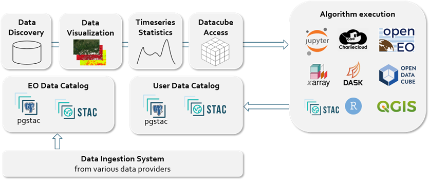
terrabyte's Data Discovery & Access Services are centered around the SpatioTemporal Asset Catalog (STAC) specification. It is used for both, describing geospatial data as well as providing a web interface (STAC API) for metadata cataloguing and data discovery.
Catalogs
Datasets in terrabyte are organized in catalogs. In order to manage different access requirements and storage models, terrabyte offers data in two distinct categories:
Curated data
- In the Curated Data Catalog, the terrabyte team offers centrally provided and
curated geodata, which can be accessed by users.
For an inventory of currently available datasets, see the Collections Overview.
User data
-
In a Private Data Catalog, users can register their non-public data in the terrabyte SpatioTemporal Asset Catalog (STAC) metadata service with the upcoming release of terrabyte. Further information will follow.
-
In a Project Data Catalog, users can register their data provided in a shared Data Science Storage (DSS) container in the terrabyte SpatioTemporal Asset Catalog (STAC) metadata service.
Additional functionality
In addition to the STAC API for data discovery, several additional services on top will be provided in the future, such as data visualization and data extraction services. STAC API is also used for terrabyte's Data Cube. All geospatial data registered either in the curated data catalog or in the private/project data catalog can be used with those services.